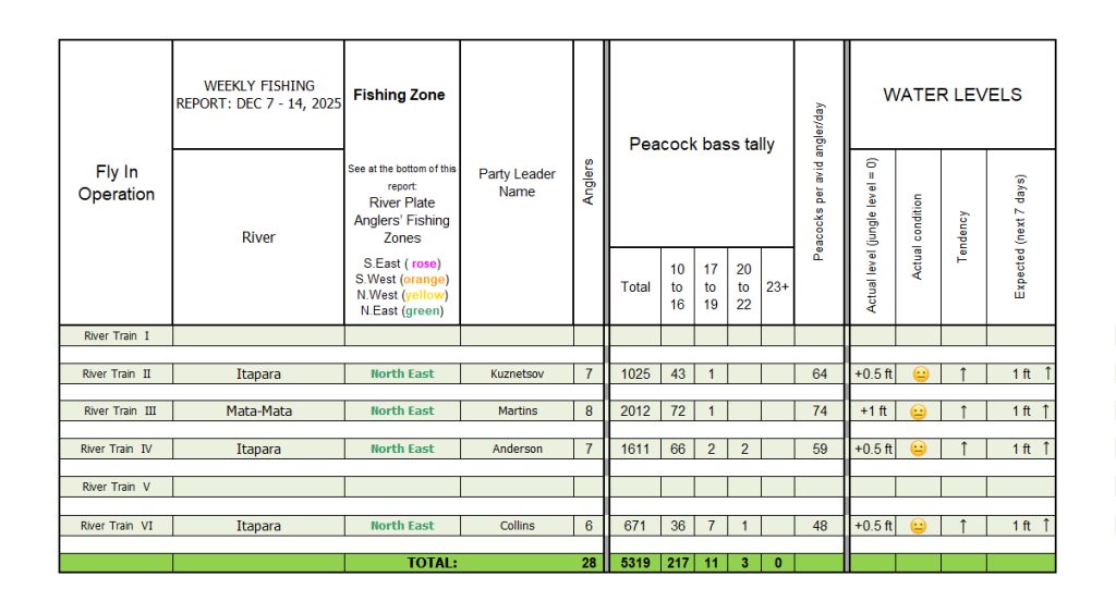
Week 23 was a typical 45-60 peacocks a day per boat, with tallies occasionally going up to 120 fish for avid fishermen with 231 peacocks a week over 10 pounds, 14 over 16 pounds ,and 3 anglers landed fish over 20 lbs. Even with high water levels across most basins, River Plate refused as always to stand still. We ventured over 300 river miles to reach the lowest fishable stretches within our 14 private rivers. Along the way, our four parties caught a total of 5319 peacocks while crafting lifetime unforgettable adventures.
TOTAL ANGLERS: 28
TOTAL PEACOCKS: 5319
OVER 10 lbs: 231
OVER 16 lbs: 14
OVER 20 lbs: 3
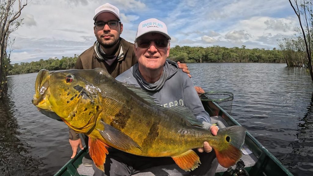
LIFE MEMORIES: On his 5th trip with River Plate Luis brought his son, Luis Jr. Both enjoyed many exciting 100 fish a day with many fish over 16 lbs. To close out the week, Luis and his son encountered the largest trophy of the trip. As the top water prop hit the surface, the echoing explosion was followed by peeling drag as the monster tore into the edge of a Mhlongo tree stand. As the fight stretched on, fatigue set in on the father, the son stood close, encouraging his dad to stay focused and keep pressure on the fish. After a long, hard battle, the monster finally gave in weighing an estimated 22 pounds of raw power.
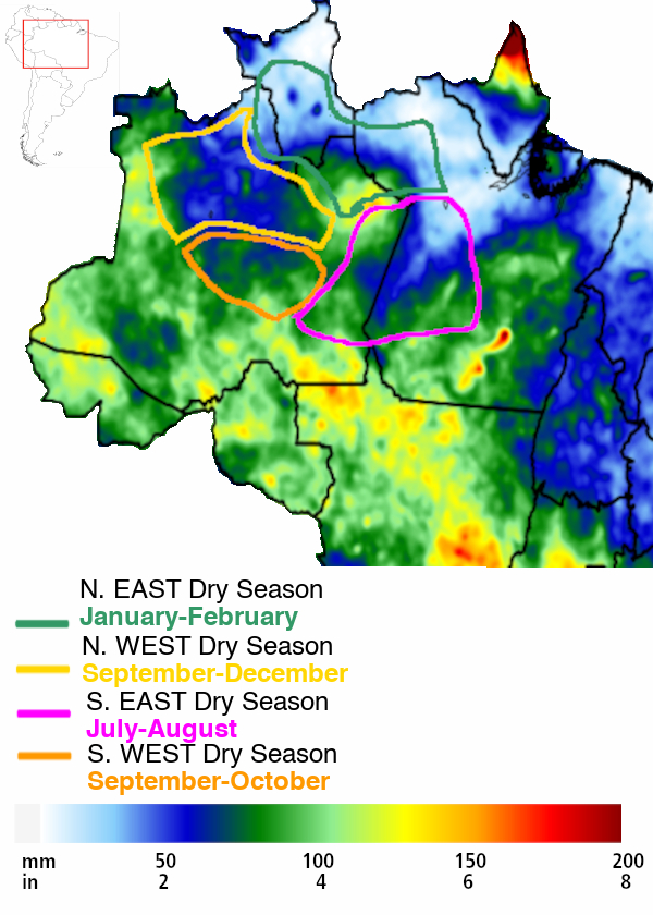
RAINFALL MANAGEMENT: Our water-level predictions are not just based on immediate rainfall forecasts but also on longer term (3-month) forecasts for unusual (or what is called anomalous) rainfall across all of our fishing zones. (see map below)
Rainfall Anomaly Forecast Map
(Valid for January-February-March)
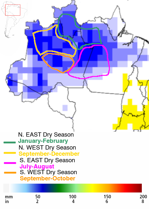
Source: CPTEC-INPE
In the above map, the areas with higher than expected rainfall are in blue, which still maintain the lowest water levels across the Amazon (Note: No unusual rainfall is expected in the white areas for the next 3 months but, these are currently with very high water as is expected this time of the year).
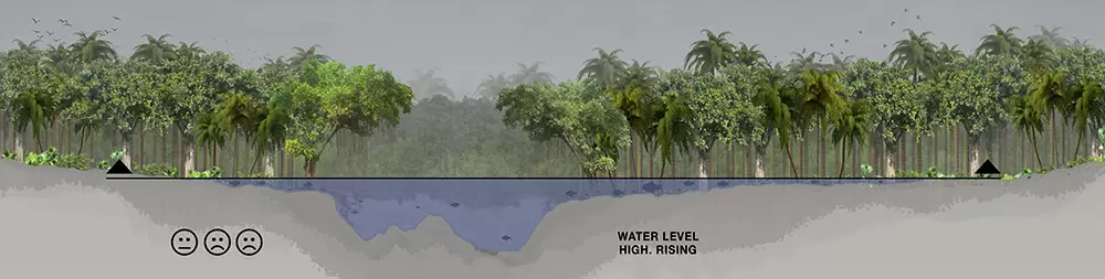
We currently have eight River Trains on this blue zone, North East Dry Zone, marked in green in the above map, with water levels at the jungle-line threshold as shown in the design below.
As evidenced by our map below, water levels may continue rising in the 6 rivers we control in the North East Zone, which is 700 miles north of the Dry Zones we were fishing 3 months ago.
Source: CPTEC-INPE
A 7-Day Forecast for more than 2 inches of rain means water levels may rise; under 2 inches means that water levels may drop. Across most of the Amazon rainfall forecast is well above the mentioned 2 inches, but since the North East Zone marked in green is just at 2 inches (see blue in map), we stand a fighting chance to be face to face against River Plate’s monsters.