Fishing Reports
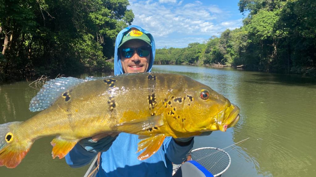
FR: July 2-9, 2022
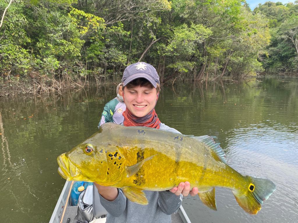
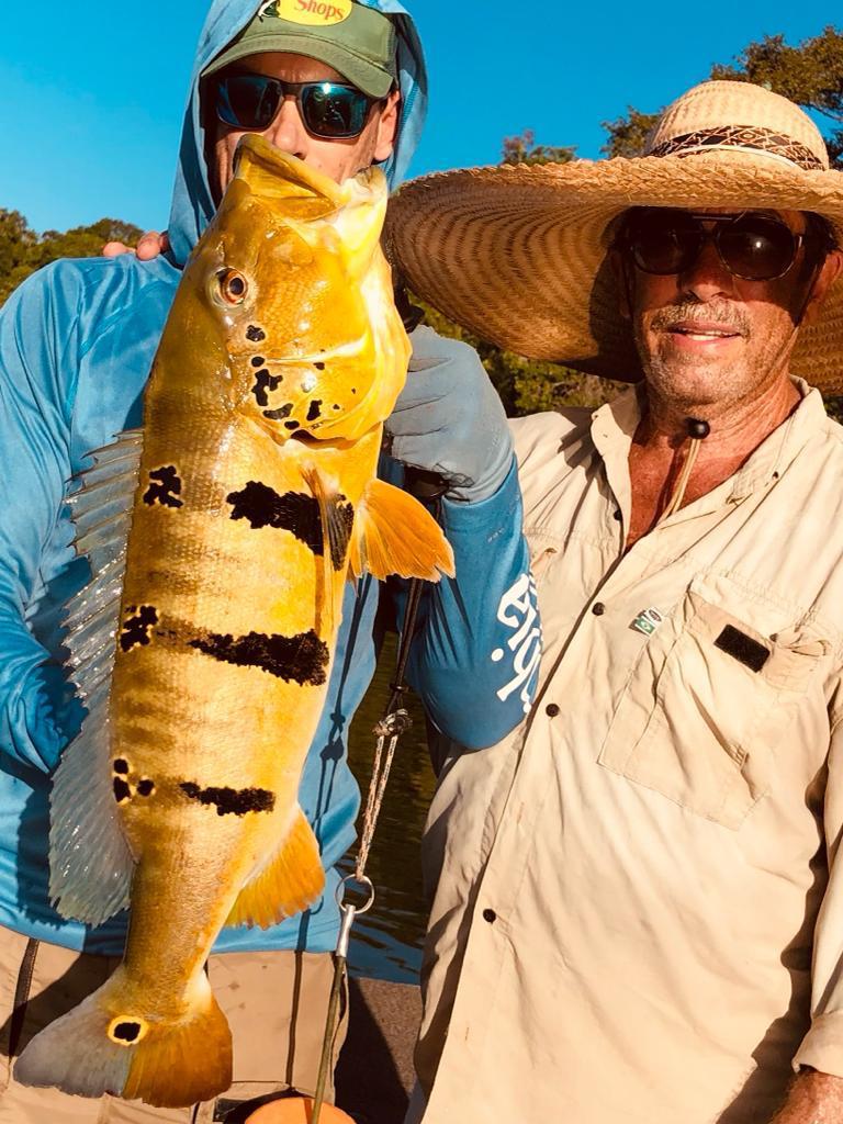
HOT & PEPPY
2,487 PEACOCKS BY 6 ANGLERS
Upper Marmelos Indian Reserve playing out as expected.
Stats: This week's 6 anglers, from the Case party, landed 2,487 peacocks with 230 fish weighing over 10 pounds. This tally includes 5-10% of other, less aggressive tropical species such as the jacundá, apapá, cachorra, oscar, aruana, wolfish, pacú, bicúda, and piraña.
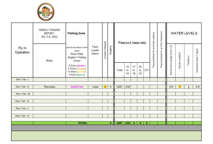
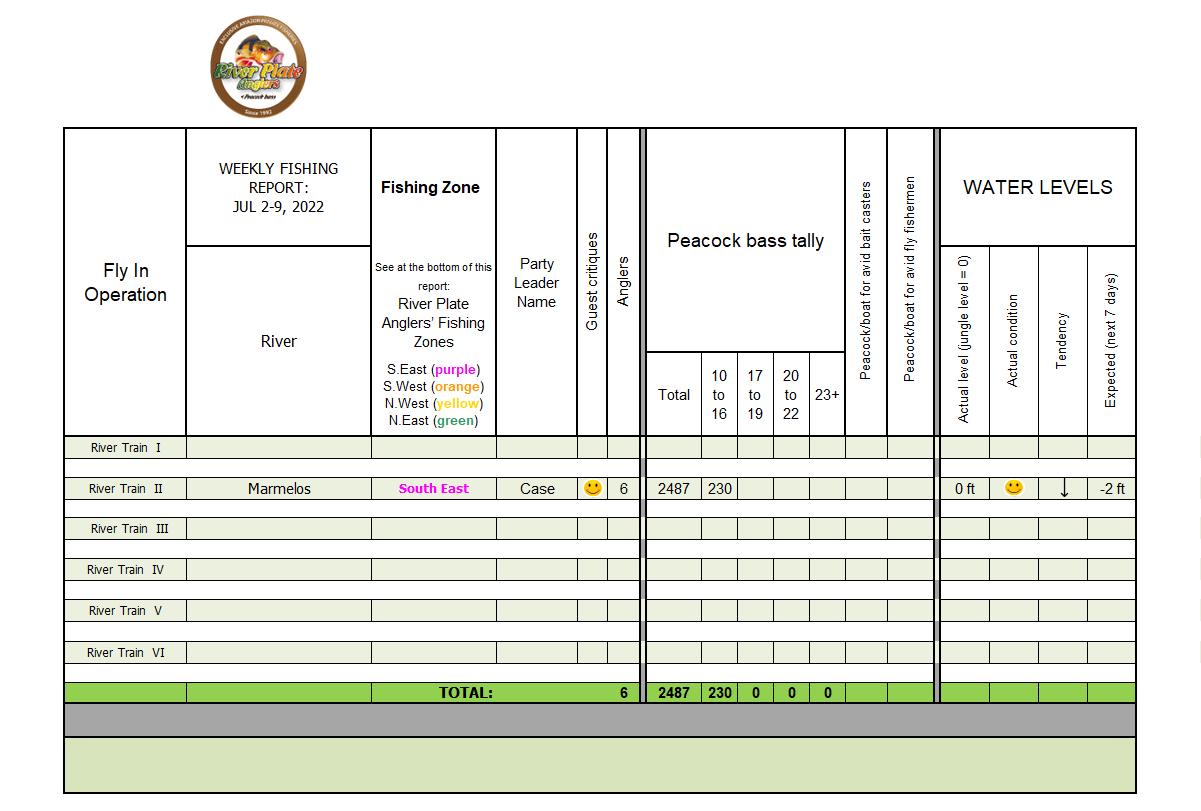
Click on the table to see full size
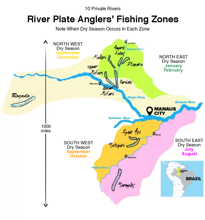
Ammo: Since we are a long way from our fishing pressure limit for this fishery set at 56 anglers, the most effective lures for bait casters are the large and noisy 6-inch topwater lures of almost any color. For fly fishermen any light colored bucktails streamers do well for larger peacocks, and poppers are deadly for smaller and midsized fish.Guesswork: We hereby wish to inform our incoming anglers where might our six River Trains be operating according to the expected water levels in our 10 Private Rivers.
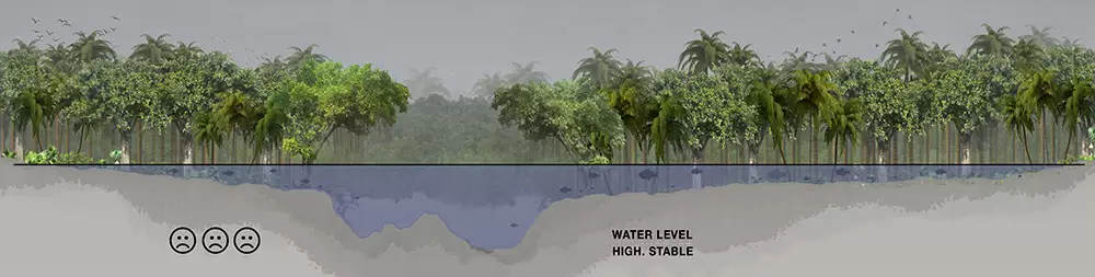
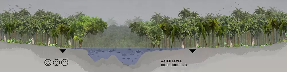
All water levels continue to be very high North and up to 200 miles South of Manaus, as illustrated in the below design.
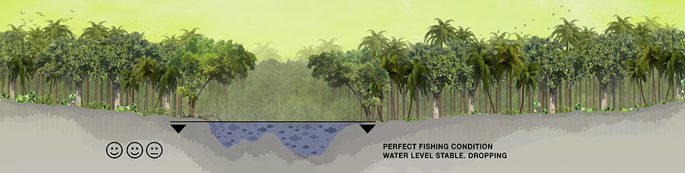
 However, in the South East Zone, 350 miles South East of Manaus, water levels continue to drain out of the jungle with fishing entering its best cycle, as illustrated in the below design.
 As such, we are now navigating with our SECOND River Train to this Dry Zone into our NEW exclusive Torrentoso River to receive simultaneous parties. Low water levels should last until mid-August, after which it may be TOO low for fish to be active. Scroll down to the Fishing Zones map to see in purple the zone we are currently fishing.
However, in the South East Zone, 350 miles South East of Manaus, water levels continue to drain out of the jungle with fishing entering its best cycle, as illustrated in the below design.
As such, we are now navigating with our SECOND River Train to this Dry Zone into our NEW exclusive Torrentoso River to receive simultaneous parties. Low water levels should last until mid-August, after which it may be TOO low for fish to be active. Scroll down to the Fishing Zones map to see in purple the zone we are currently fishing.
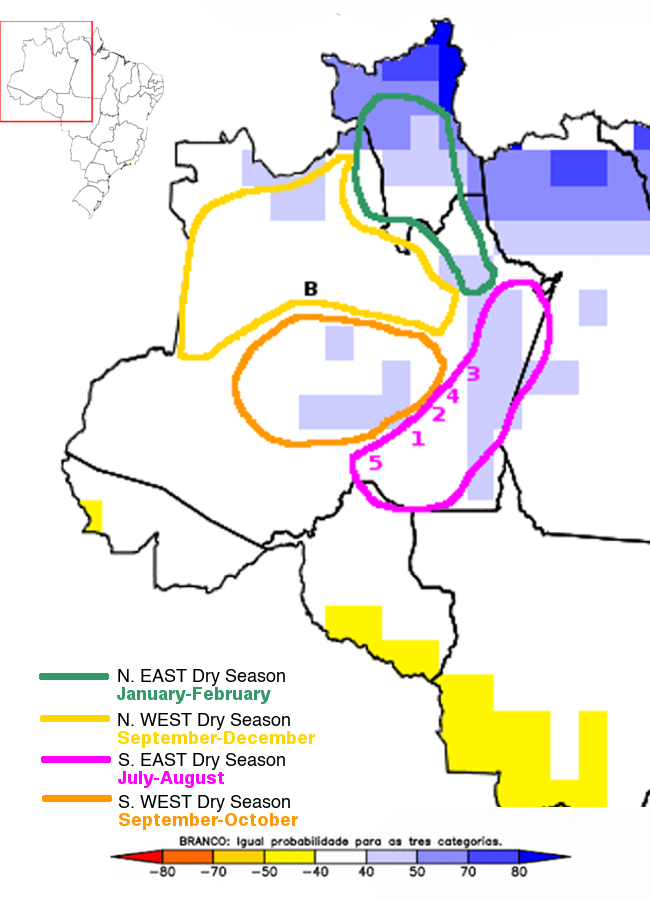
These low expected water levels are evidenced by Today’s and Last Week’s 10-Day Accumulated Rainfall Forecast. These forecasts are for the towns below printed in purple which impact water levels in the South East Zone.
Today’s 10-Day Forecast is as follows (by order of importance):
- Humaita: 0.16 inches (Marked as "1" in the map below)
- Apuí: 0.07 inches (idem "2")
- Manicore: 0.09 inches (idem "3")
- Novo Aripuana: 0.20 inches (idem "4")
- Borba: 0.27 inches (idem "5")
- Barcelos: 2.60 inches (Marked as "B" on the map, included only as reference since it is OUTSIDE our selected Dry Zone)
- Humaita: 0.04 inches (Marked as "1" in the map below)
- Apuí: 0.08 inches (idem "2")
- Manicore: 0.31 inches (idem "3")
- Novo Aripuana: 0.41 inches (idem "4")
- Borba: 0.46 inches (idem "5")
- Barcelos: 2.80 inches (Marked as "B" on the map, included only as reference since it is OUTSIDE our selected Dry Zone)
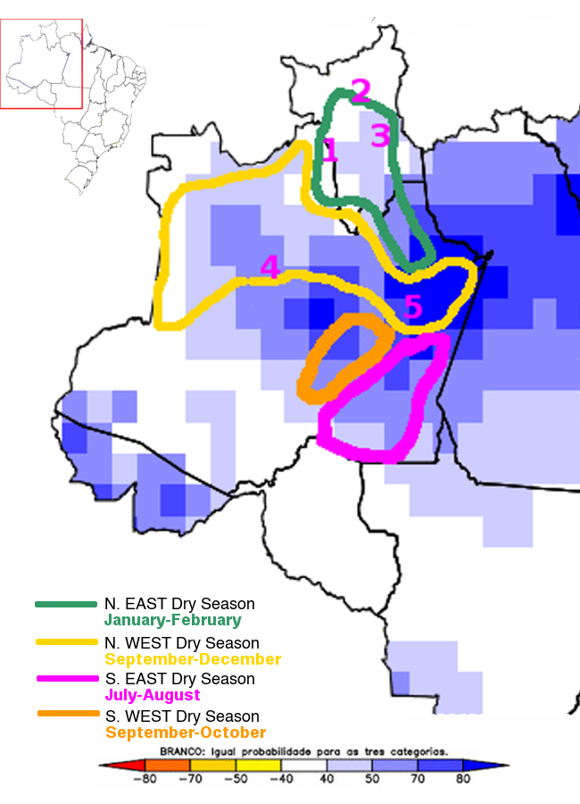
3-Month Rain Anomaly Forecast In Our Four Fishing Dry Zones
(Valid for July-August-September)
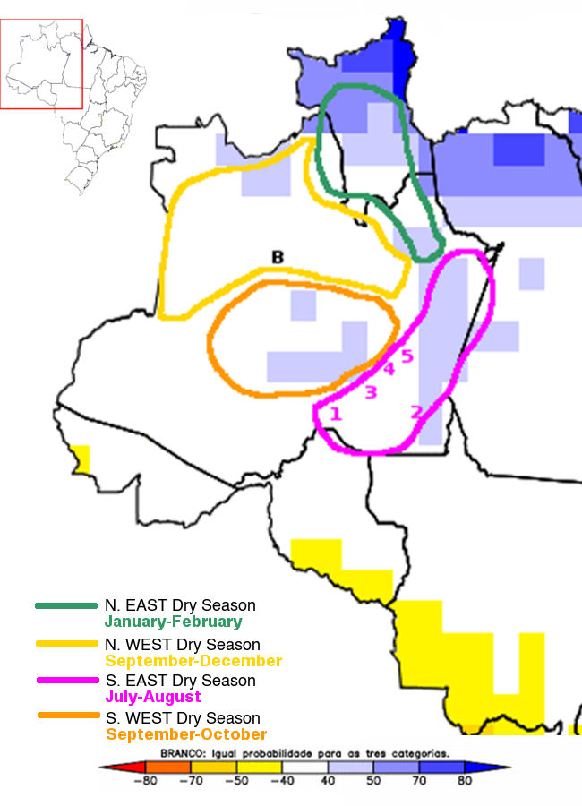
Source: CPTEC/INPE, Brazil.
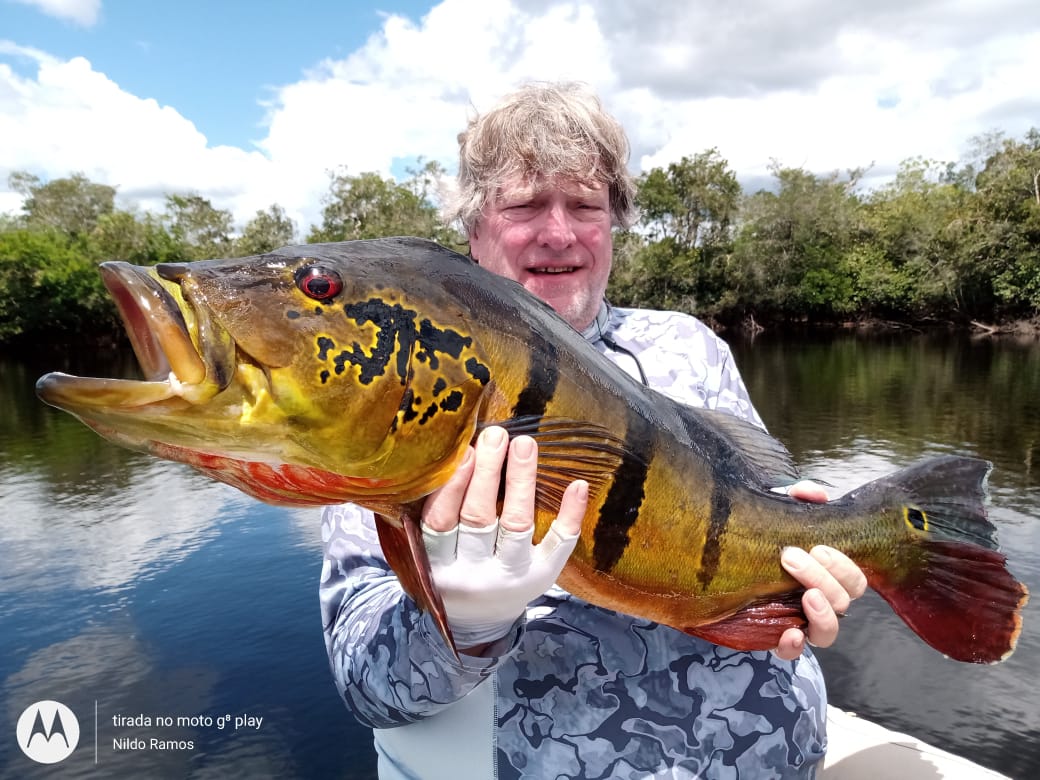
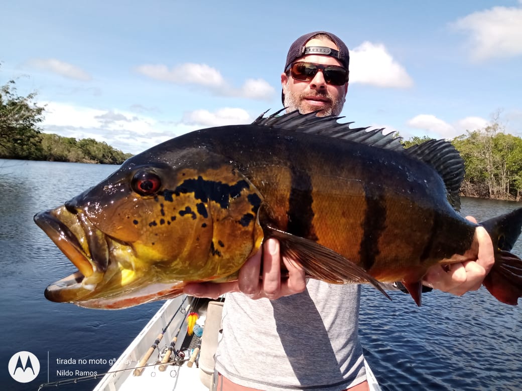
Our guesswork is further evidenced in the map above. The white color means normal rainfall forecasted for the next 3 months. Note that our current selected fishing area from June to August, the South East Zone, is in white meaning that there is NO anomaly forecasted; i.e.: this zone should receive the expected rainfall for THIS TIME of the year which is historically very little rain (less than 0.75 inches accumulated in 10 days).THIS WEEK'S GALLERY
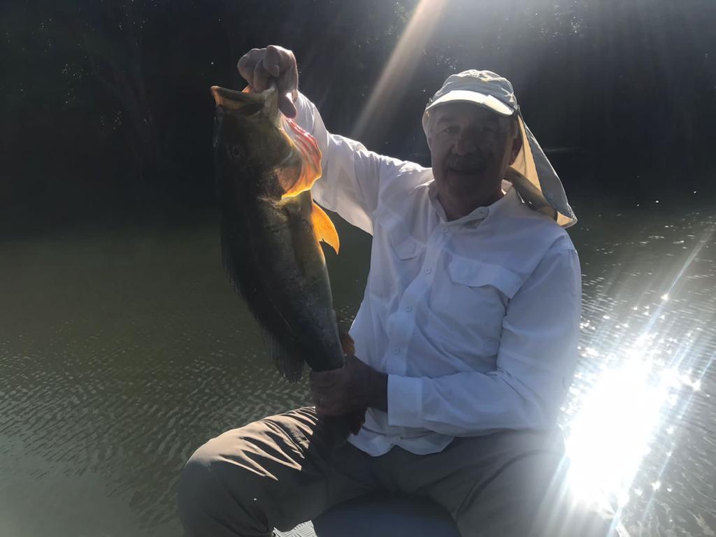
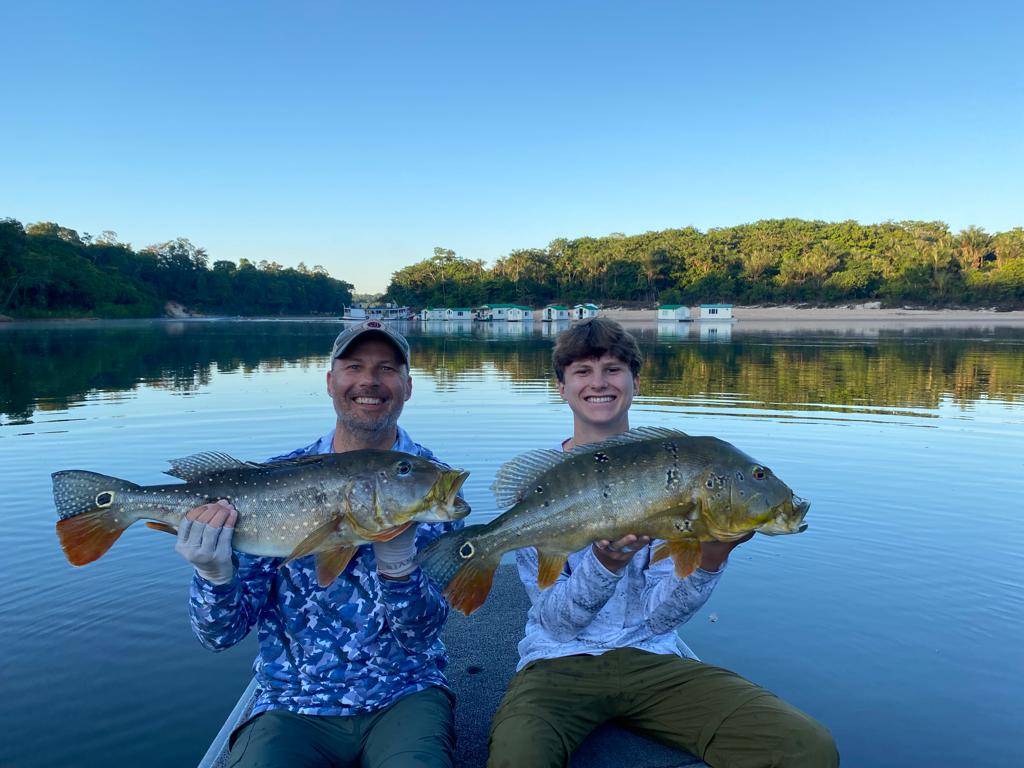
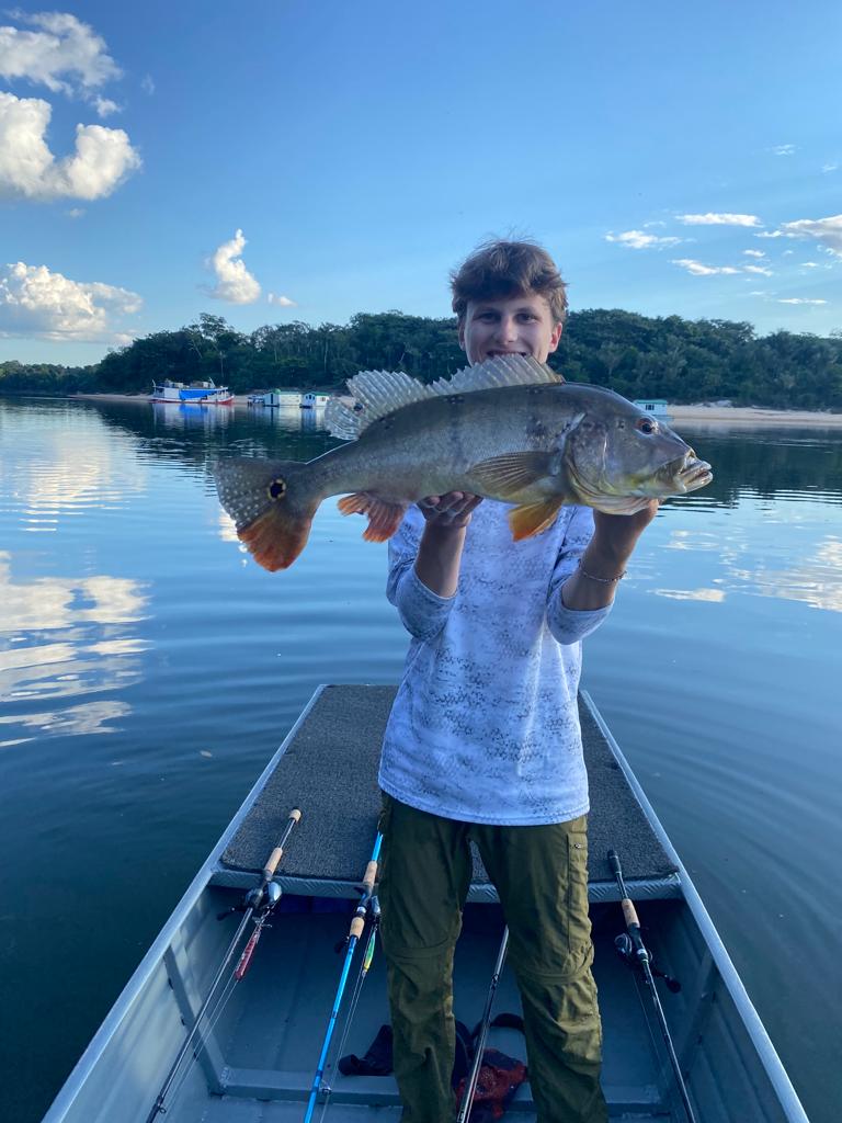
FR: June 25-July 2, 2022
SEASON KICK-OFF
2,081 PEACOCKS BY 6 ANGLERS
Breaking waters on the upper Marmelos Indian Reserve with no time outs.
Stats: From June 25th thru July 2nd 6 anglers landed in 6 ½ days 2,081 peacocks with over 22 fish in the teens.This tally excludes a multifarious array of other tropical species such as the jacundá, apapá, cachorra, oscar, aruana, wolfish, pacú, bicúda, and pirañha.
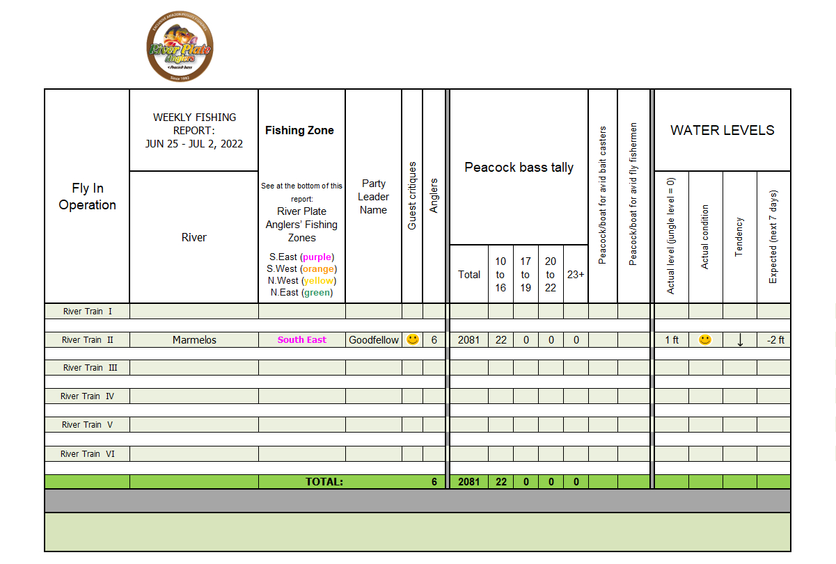 Click on the table to see full size
Guesswork:We hereby wish to inform our incoming anglers where might our six River Trains be operating according to the expected water levels across our 10 Private Rivers. All water levels continue to be high North and up to 200 miles South of Manaus as may be seen in the below design.
However, in the South East Zone, 350 miles South East of Manaus, water levels as they drain out of the jungle are increasingly going from very good to perfect, as may be seen in the below design.
 As such, we transferred one of our River Trains into this Dry Zone where low water levels should only last until mid-August after which it may be TOO low for fish to be active, OR we would have reached our fishing pressure limit for this fishery of 56 anglers. Scroll down to see in purple, in the Fishing Zones map, the area where we are currently fishing.
These low expected water levels are evidenced by Today's and Last Week’s 10-Day Accumulated Rainfall Forecast. Scroll down further to see these forecasts.
As such, we transferred one of our River Trains into this Dry Zone where low water levels should only last until mid-August after which it may be TOO low for fish to be active, OR we would have reached our fishing pressure limit for this fishery of 56 anglers. Scroll down to see in purple, in the Fishing Zones map, the area where we are currently fishing.
These low expected water levels are evidenced by Today's and Last Week’s 10-Day Accumulated Rainfall Forecast. Scroll down further to see these forecasts.
However, in the South East Zone, 350 miles South East of Manaus, water levels as they drain out of the jungle are increasingly going from very good to perfect, as may be seen in the below design.
As such, we transferred one of our River Trains into this Dry Zone where low water levels should only last until mid-August after which it may be TOO low for fish to be active, OR we would have reached our fishing pressure limit for this fishery of 56 anglers. Scroll down to see in purple, in the Fishing Zones map, the area where we are currently fishing.
These low expected water levels are evidenced by Today's and Last Week’s 10-Day Accumulated Rainfall Forecast. Scroll down further to see these forecasts.
10-Day Accumulated Rainfall Forecasts are for the nearby towns below marked in purple which impact water levels in the South East Zone.
The accumulated rainfall over 2 inches means water levels may rise; and under 2 inches means that water levels may drop. Since the actual average of Today’s and Last Week’s 10-Day Accumulated Rainfall in all neighboring cities is LESS than 0.75 inches, water levels will HASTILY continue to drop.
Today’s 10-Day Accumulated Rainfall Forecast is as follows:
- Manicore: 0.31 inches (marked as “1” in the 3 Month Rain Forecast Map below)
- Novo Aripuana: 0.41 inches (idem “2”)
- Autazes: 0.58 inches (idem “3”)
- Borba: 0.46 inches (idem “4”)
- Humaita: 0.04 inches (idem “5”)
- Manicore: 0.51 inches (marked as “1” in the 3 Month Rain Forecast Map below)
- Novo Aripuana: 0.51 inches (idem “2”)
- Autazes: 0.51 inches (idem “3”)
- Borba: 0.65 inches (idem “4”)
- Humaita: 0.22 inches (idem “5”)
3-Month Rain Anomaly Forecast In Our Four Fishing Dry Zones
(Valid for July-August-September)
Source: CPTEC/INPE, Brazil
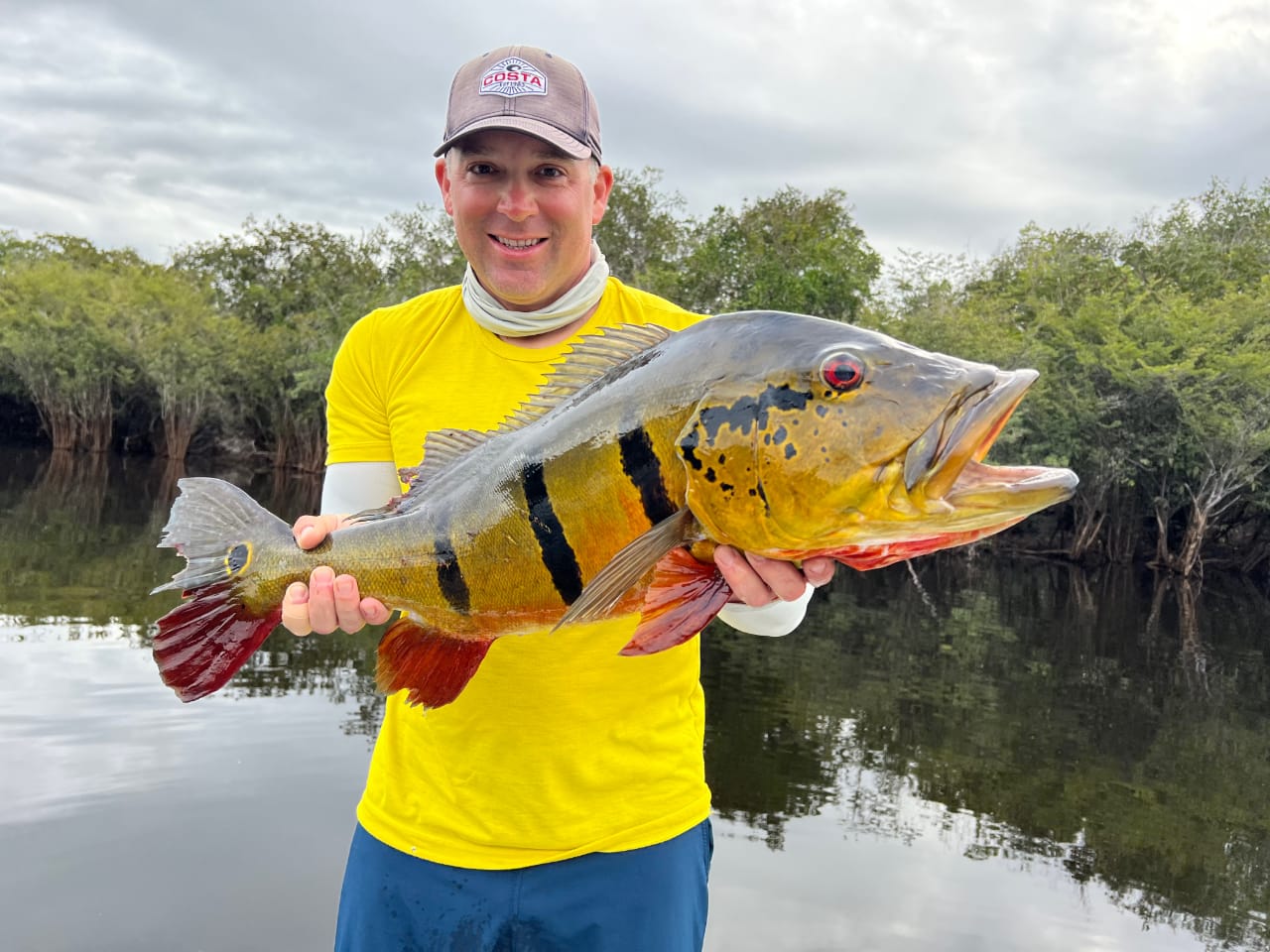
In the map above, the white color means normal rainfall forecasted. Note that our selected fishing area from June to August, which is the South East Zone, is in white, meaning that there is no anomaly; i.e.: this zone should receive about the expected rainfall for this time of the year. We are currently in the dry season south of the Amazon, as Today’s and Last Week’s 10-Day Accumulated Rainfall Forecasts show, so we expect water level in the area to drop over the following weeks.THIS WEEK'S GALLERY

--END OF PREVIOUS SEASON--
Fishing Report: January 29th to February 19th, 2022
BEST-OF-BEST
2,050 Peacocks By 8 Anglers
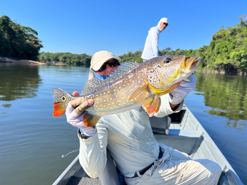
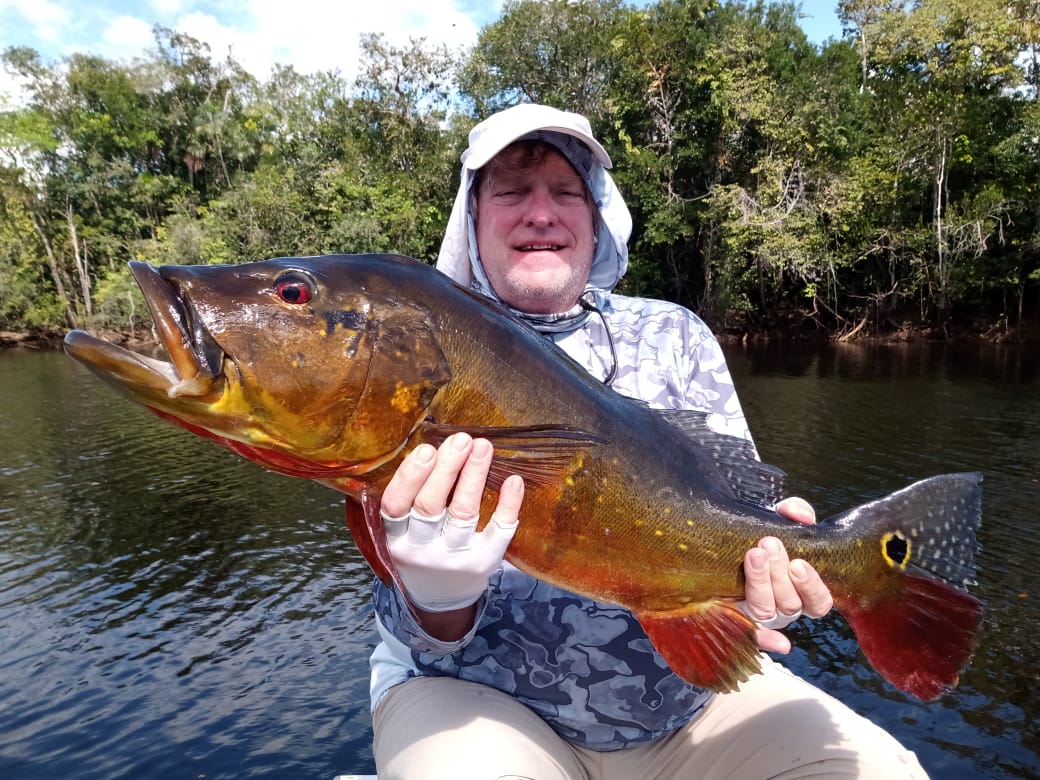
Our 43 anglers during February had excellent fishing. Eight anglers broke waters on the upper Itapara with 2,050 peacocks of which 11 were 17-18lbs, two 19 lbs, one 20lbs, and one 21 lbs.
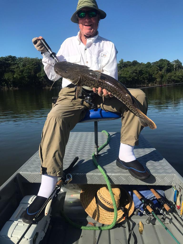
Stats: From January 29th thru February 19th 43 anglers landed in 6 ½ days 7,743 peacocks with 437 peacocks between 10 and 16 lbs.; 32 between 17 and 19 lbs.; and 6 between 20 and 22 lbs. (see the chart below) This tally excludes 4 large arapaimas, 7 large catfish, and a multifarious array of other tropical species such as the jacundá, apapá, cachorra, oscar, aruana, wolfish, pacú, bicúda, and pirañha.
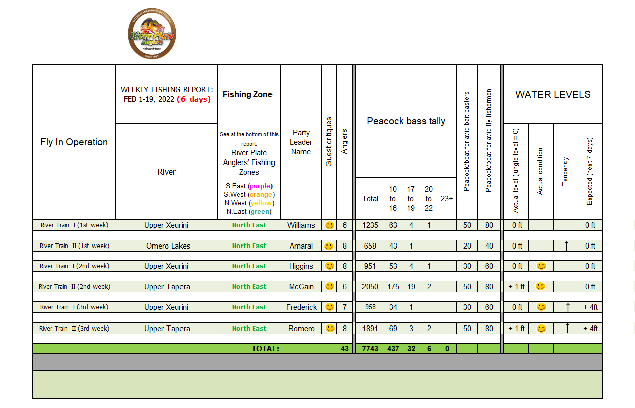 (click on the table to see it at full size)
Guesswork:
Below we wish to inform our incoming anglers about the six River Train destinations, according to the expected water levels across our 10 Private Rivers.
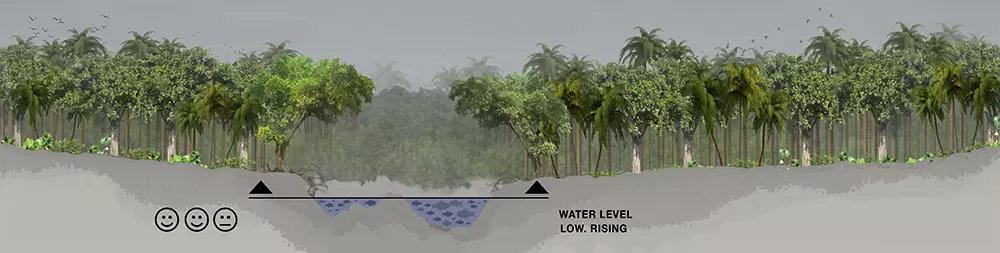
South West Zone & South East Zone (scroll down to see map): All water levels continue to be high from Manaus down to 500 miles south as may be seen in the below design, which is normal at this time of the year.
As such, we transferred two months ago all River Trains 300-400 miles North of Manaus to the North East Dry Zone were water levels and fishing have been very good. We fished a bit over the sustainable capacity on the Omero and Mata-Mata lakes waiting for low levels on the other private rivers in this Dry Zone. Finally, in the beginning of February we broke waters in our upper exclusive segments on the Itapara Jufaris and Xeurini . Water levels on these areas are excellent, see design below.
 However, these low water levels will only last until the end of February which, anyway, is the end of the season. This sudden future rise of water levels is evidenced by Todays and Last Week’s 10-Day Accumulated Rainfall Forecast being very high. Scroll down to see these forecasts.
As such, we transferred two months ago all River Trains 300-400 miles North of Manaus to the North East Dry Zone were water levels and fishing have been very good. We fished a bit over the sustainable capacity on the Omero and Mata-Mata lakes waiting for low levels on the other private rivers in this Dry Zone. Finally, in the beginning of February we broke waters in our upper exclusive segments on the Itapara Jufaris and Xeurini . Water levels on these areas are excellent, see design below.
However, these low water levels will only last until the end of February which, anyway, is the end of the season. This sudden future rise of water levels is evidenced by Todays and Last Week’s 10-Day Accumulated Rainfall Forecast being very high. Scroll down to see these forecasts.
10-Day Accumulated Rainfall Forecasts are for the towns below marked in pink which impact water levels in the North East Zone.
The accumulated rainfall over 2 inches means water levels may rise; between 1.5 and 2 inches means that water levels may drop slowly. On the other hand, rainfall between 1.5 and 1.0 inches means that levels will drop rapidly. Since the actual average of Today’s and Last Week’s 10-Day Accumulated Rainfall are more than two inches, water levels will rise.
Today’s 10-Day Accumulated Rainfall Forecast is as follows:
- Caracarai: 3.82 inches (marked as “1” in the 3 Month Rain Forecast Map below)
- Boa Vista: 1.78 inches (idem “2”)
- Rorainopolis: 4.69 inches (idem “3”)
- Barcelos: 4.11 inches (idem “4”) maybe considered slightly outside our fishery sphere-of-influence.
- Manaus: 4.36 inches (idem “5”) is outside our fishery sphere-of-influence. Used only as a reference.
- Caracarai: 1.87 inches (marked as “1” in the 3 Month Rain Forecast Map below)
- Boa Vista: 0.83 inches (idem “2”)
- Rorainopolis: 2.15 inches (idem “3”).
- Barcelos: 2.85 inches (idem “4”) maybe considered slightly outside our fishery sphere-of-influence.
- Manaus: 3.57 inches (idem “5”) is outside our fishery sphere-of-influence. Used only as a reference.
3-Month Rain Anomaly Forecast In Our Four Fishing Dry Zones
(Valid for February-March-April)
Source: CPTEC/INPE, Brazil
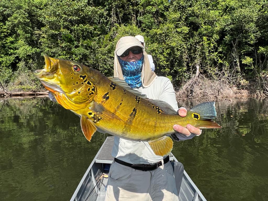
In the map above, the white color means normal rainfall forecasted. Note that our selected fishing area during January and February, which is the North East Zone, is in light blue, meaning that there is a slight positive anomaly; i.e.: this zone should receive slightly more rainfall than expected for this time of the year. Moreover, by Today’s and Last Week’s 10-Day Accumulated Rainfall Forecast shows that areas (towns) 1, 2 and 3 show high expected rainfall which is normal during season-end.This Week's Gallery