Fishing Reports
Fishing Report: September 28th, 2021
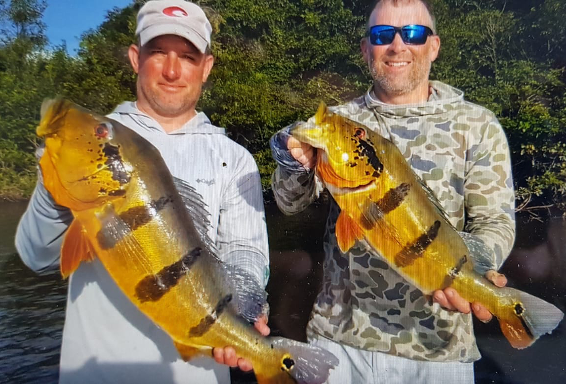
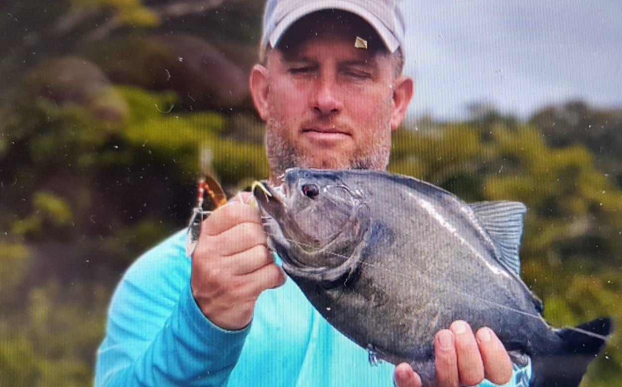
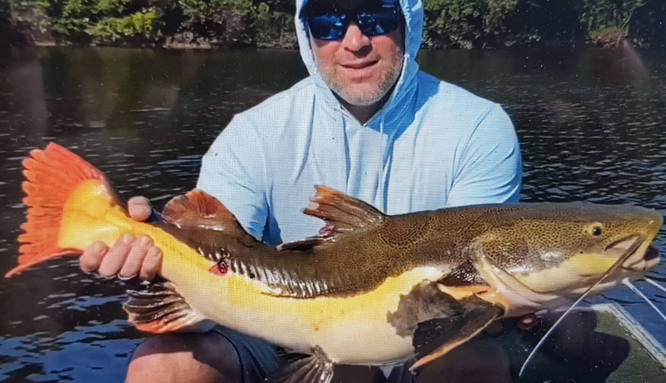
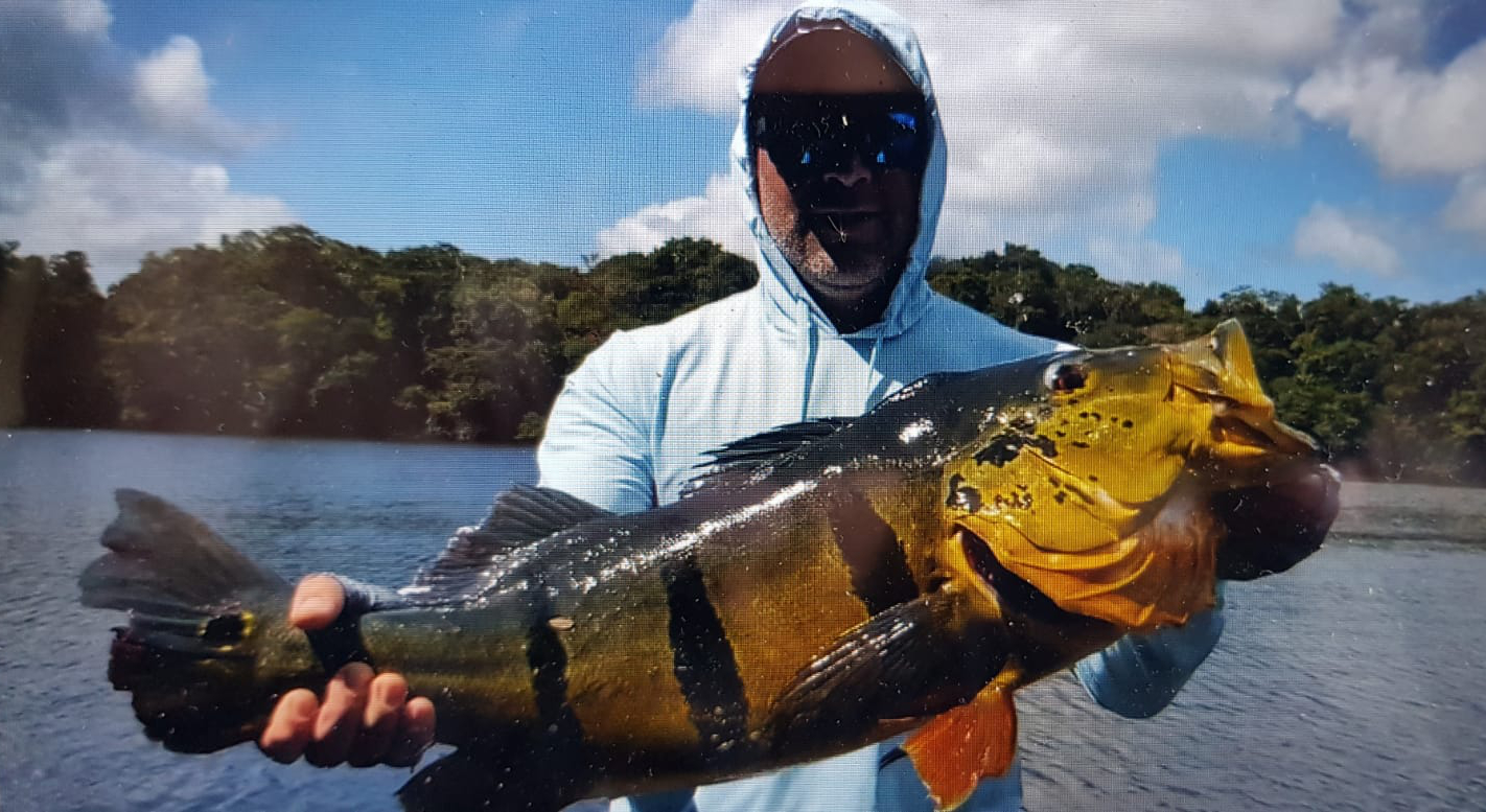
Season Opening with 2.563 peacocks!
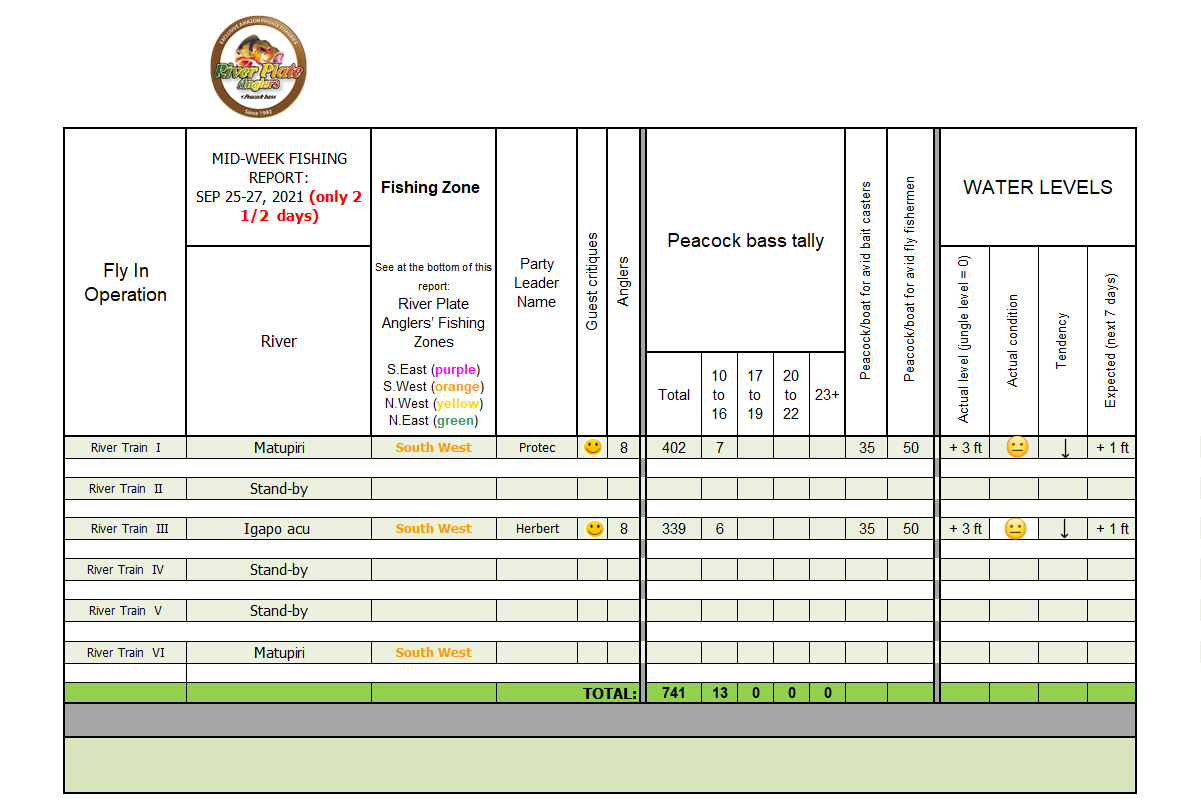 (click on the table to see it at full size)
Water level report on South West Zone
(see Fishing Zones map below)
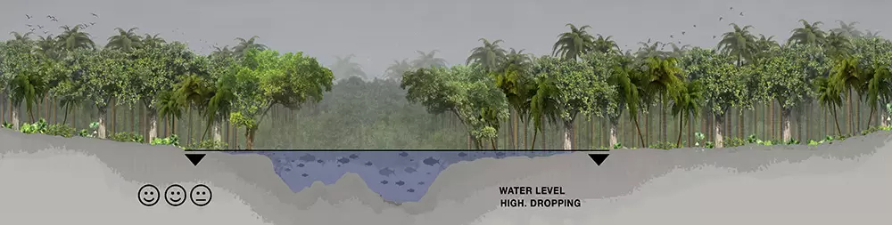 Water levels in the Matupiri and Igapo-Acu continue to drop very slowly, and this trend should remain over the next couple of weeks, as seen below in our guesswork data analysis which forecasts above average rainfall for this time of the year.
- Manicore: 1.65 inches (marked as “1” in the 3 Month Rain Forecast Map)
- Novo Aripuana: 2.45 inches (idem “2”)
- Autazes: 1.17 inches (idem “3”)
- Borba: 1.16 inches (idem “4”)
- Humaita: 2.30 inches (idem “5”)
- Manicore: 1.58 inches
- Novo Aripuana: 1.26 inches
- Autazes: 0.94 inches
- Borba: 1.02 inches
- Humaita: 1.71 inches
3-Month Rain Anomaly Forecast In Our Four Fishing Season Zones
(valid for September-October-November)
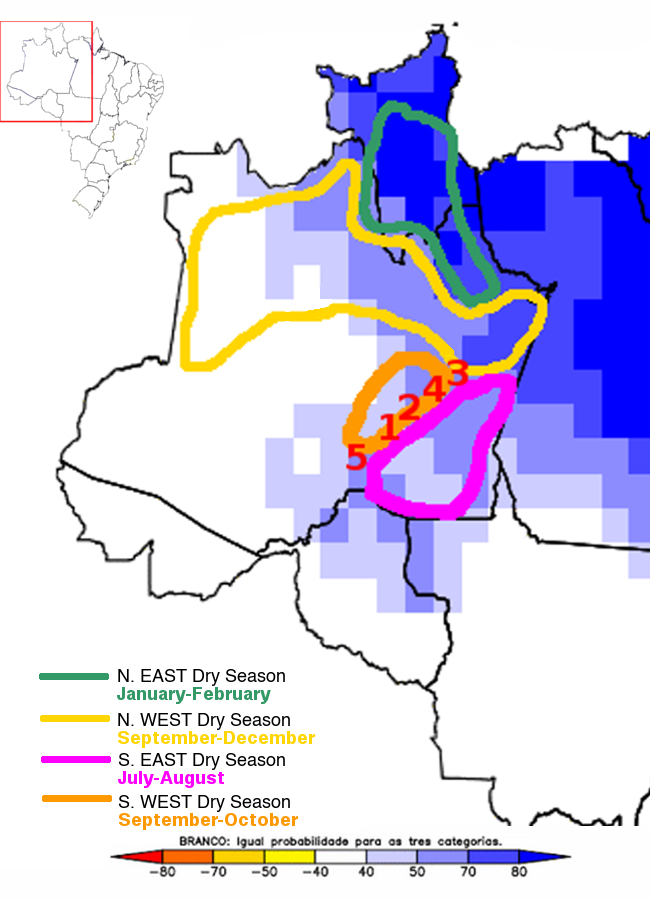 Source: CPTEC/INPE, Brazil
2021-2022 Season Preview: August 27th, 2021
2021-2022 Season Preview
Water Level Report on South West Zone
(see Fishing Zones map below)
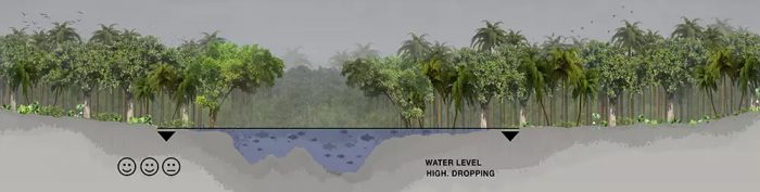
Water levels in the Matupiri are still high, but expected to drop to just about acceptable level by the time our first anglers arrive in September. This can be further evidenced in Today's 10-Day Accumulated Rainfall Forecasts.
- Manicore: 1.7 inches (marked as “1” in the 3 Month Rain Forecast Map)
- Novo Aripuana: 2.08 inches (idem “2”)
- Autazes: 1.73 inches (idem “3”)
- Borba: 2.14 inches (idem “4”)
- Humaita: 1.48 inches (idem “5”)
3-Month Rain Anomaly Forecast In Our Four Fishing Season Zones
(valid for August-September-October)
Source: CPTEC/INPE, Brazil
In the map above, note that our preferred fishing area for this time of the year, South West Zone, is in white which means no anomalies; ie.: it should receive exactly the expected (low) rainfall for this time of the year.Fishing Report, February 20-27 2021
Touch down!
Last week of the season:
Six anglers; 1093 fish!
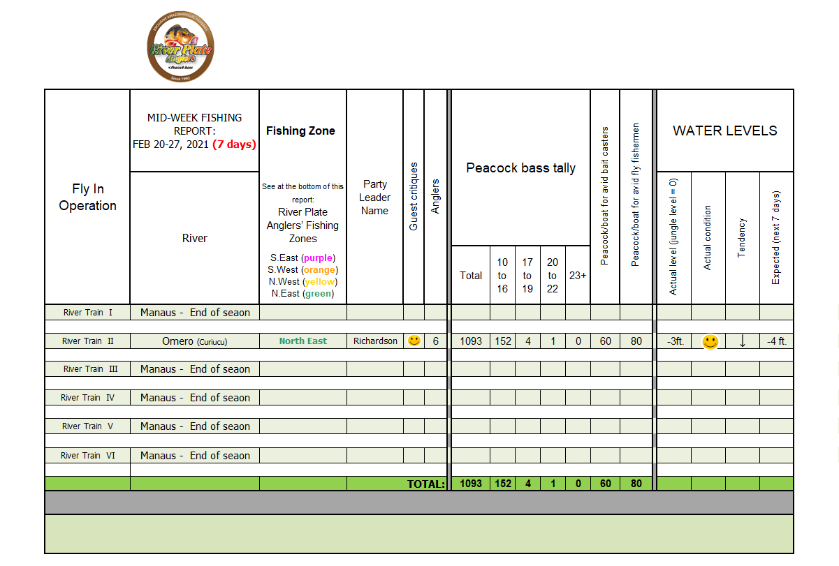
Click on the table to see the full image.
3-Month Rain Forecast Map
(valid for January-February-March)
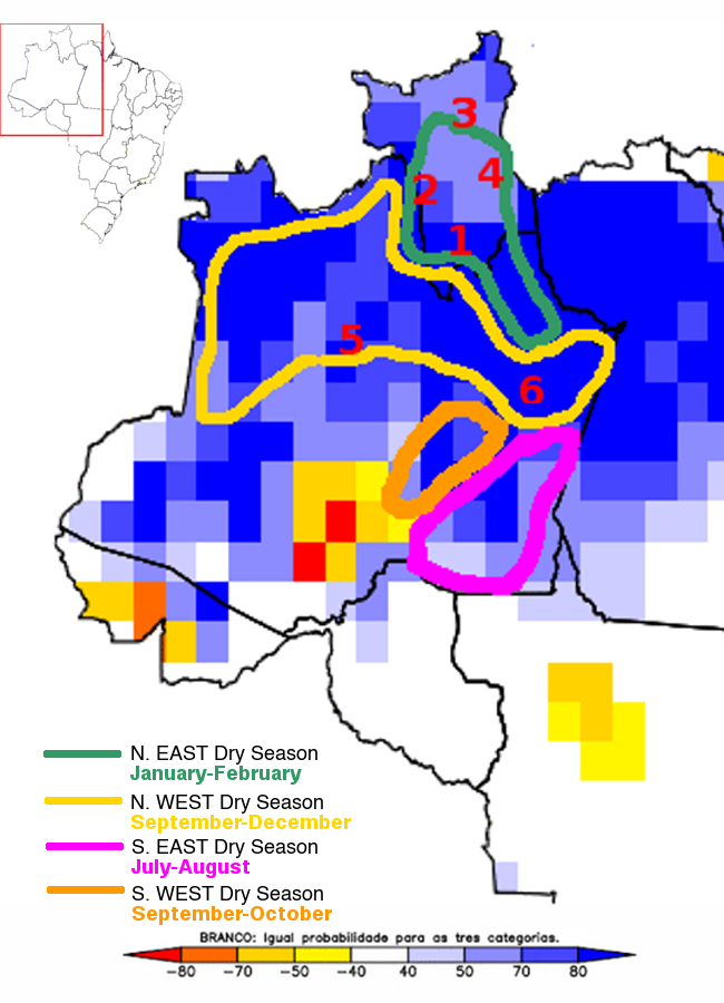
Source: CPTEC/INMET/FUNCEME
In the map note that our favored area for this time of year, North East Zone, with numbers 1,2,3 and 4, should experience less rainfall than any of our other Fishing Zones. Meanwhile, the Barcelos area, number 5, where most anglers fish (in public waters) is in the high rainfall area colored in blue. And, the city of Manaus as a reference is number 6. In conclusion, our guesswork for the end of season was accurate.
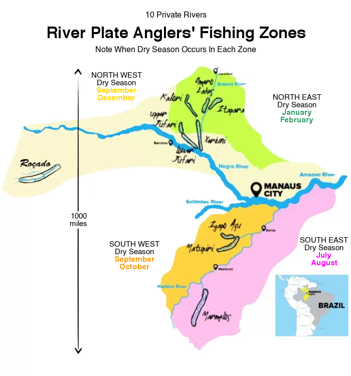
River Plate Anglers has access to 10 private river areas that drain some 30 million acres of pristine Amazon rainforest populated almost exclusively by indigenous groups that allow River Plate to fish their waters on an exclusive basis in return for various forms of support. Having so many rivers is part of our River Plate Advantage™. The other part of our River Plate Advantage™ is keeping up to date on water levels in all those areas. We do that from an office complex in Montevideo, Uruguay, we have dubbed our Situation Room. There, we pore over river data and weather forecasts basin-wide on a daily basis to ensure our anglers fish waters that are in prime condition. Our competitors, with few waters to fish, poor mobility, and limited insight into basin-wide water level fluctuations rely largely on guessing and hoping. We rely on facts. Here is a zone-by-zone snapshot of what is happening at the three Fishing Zones not mentioned in this report:
North West Zone: Water levels in this zone up to 400 miles north west of Manaus are too high, which is not normal for this time of the year. Therefore, we have moved most of our stand-by operations out of this zone and into the above mentioned Omero lakes system.
South East Zone: Water levels in this zone 150 miles south of Manaus are extremely high, which is above normal for this time of the year, but it is too soon to say if it will have an impact. (Remember River Plate has Private Rivers, so we can move to the best Dry Season Zone).
South West Zone: Water levels in this zone 400 miles south of Manaus are dropping rapidly, which is normal for this time of the year.This week's gallery